
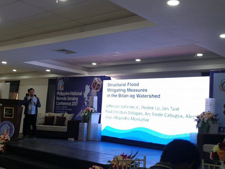
BIG WINNER. Engr Jefferson R Vallente Jr of Xavier Ateneo’s Civil Engineering department presents their study, "Structural Flood Mitigating Measures in Bitan-ag Watershed at the 2017 Philippine National Remote Sensing Conference. Photo by Julemer Ann G Aying.
A faculty member of Xavier Ateneo’s Civil Engineering department was awarded the Best Oral Paper Presentation at this year's Philippine National Remote Sensing Conference (PNRSC) held in Butuan City.
Engr Jefferson R Vallente Jr bagged the award for their paper, “Structural Flood Mitigating Measures in Bitan-ag Watershed,” under the Disaster Management & Climate Change Impacts and Adaptions category during the national conference dubbed as “Remote Sensing for the People” held from November 28 to 29.
The research investigates the effect of channel enlargement and detention ponds as means to alleviate flooding problems in Bitan-ag Creek over a 25-50 year rain event. It utilized extensive data from field observations and remote sensing data using a combination of hydrologic and hydraulic modeling. This shows the effectiveness of the flood mitigating measures, which is its capacity to reduce the flooded area, combining channel enlargement and detention ponds.
The said paper was co-authored with XU Engineering faculty members Engr Dexter Lo and Engr Jan Taat and Xavier Ateneo alumni Paul Christian Dalagan, Arc Siede Cabugsa, Alec Joyo, and Alejandro Montañer.
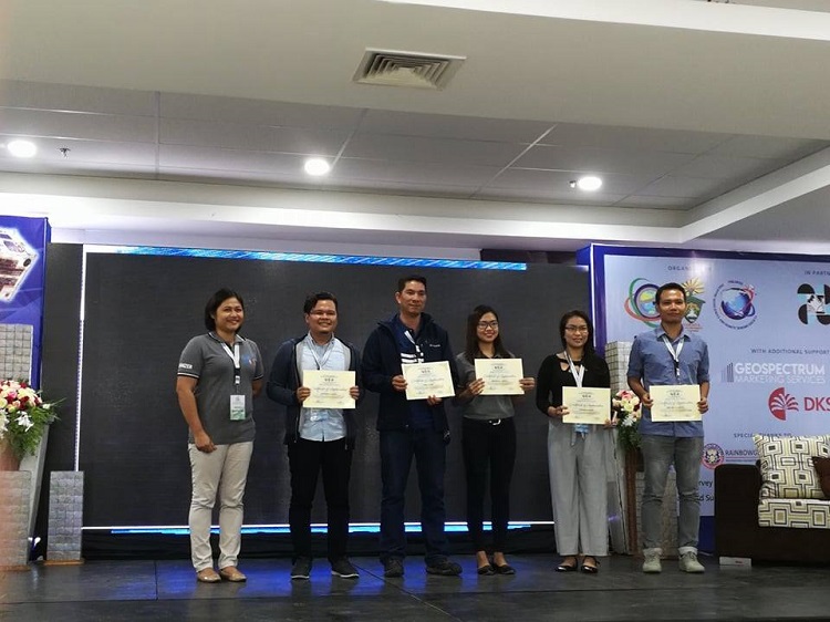
AWARDING CEREMONY. Engr Jefferson R Vallente Jr (second from the left) takes home the Best Oral Paper Presentation Award at this year's Philippine National Remote Sensing Conference (PNRSC) held in Butuan City. Photo by Julemer Ann G Aying.
Two other papers from Xavier Ateneo were also presented under the Urban Infrastructure category, namely:
1. “Hydraulic and Hydrologic Analysis of the Iponan Watershed with the Dike System,” co-authored with CE faculty members Engr Lo and Engr Taat and alumni Casey Alla, Czarina Ann Casirayan, Mark Jayson Portarcos, Nico Miguel Tabanas, and Allen Jay Wee Eng; and
2. “Landslide Risk Assessment in Five Selected Barangays in Cagayan de Oro City, Philippines,” co-authored with CE faculty member Dr Gerardo Apor and alumni Therese Zennia Marie Estenzo, Russel Paluya, Jasper Peñamante, and Kevyn Gerard Tan
The conference organized by the Philippine Geosciences and Remote Sensing Society (PhilGRSS), in partnership with the Department of Science and Technology (DOST), showcased some of the recent advancements in Remote Sensing Technologies and Geo-Information System (RST-GIS) applications all over the country.
Around 100 papers were presented at the said conference highlighting the different applications of the emerging RS-GIS and space technology in the Philippines, especially for the PHL-Microsat program.∎