
By Audrey Yvonne E. Cinco, Intern, OICN
The Xavier Ateneo team, composed of Dr Hercules R Cascon, Dean of the College of Engineering and Project Lead of the geoDRR project in Xavier Ateneo, Engr Dexter S Lo, Vice-President for Social Development, and Engr Jefferson R. Vallente Jr, Research Coordinator for the College of Engineering, represented Xavier University-Ateneo de Cagayan at the European Union’s Erasmus Plus geoDRR project's 4th educational study visit and 5th transnational meeting last January 7-13 at the Universiti Sains Malaysia (USM) in Penang, Malaysia.
The conference was attended by the consortium partners of the geomatics for Disaster Risk Reduction (geoDRR) project, which included a consulting firm and nine (9) higher education institutions (HEIs) from Europe and Asia.
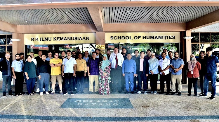
Participants of partner institutions form Poland, Greece, Spain, Luxembourg, Cambodia, Malaysia, and the Philippines to the GeoDRR Project Meeting and Workshop
The meeting was held over five days, over the course of a week. Primary subjects of discussion within the meeting included reports on the progress of the project from the manager, Dr Kryzsztof Tomiczek, an assistant professor at the Silesian University of Technology (SUT) in Poland, and the project leaders of six (6) Asian university partners. Namely, the Universiti Utara Malaysia (UUM) and Universiti Sains Malaysia (USM) in Malaysia, the National University of Battambang (NUBB) and Svay Rieng University (SRU) in Cambodia, University of the Cordilleras (UC) and Xavier University-Ateneo de Cagayan (XU) in the Philippines.
Several lectures were also held to enrich the participants’ knowledge related to geoDRR. Topics included the roles of geomatics in DRR and their research methodologies; an introduction to hazards and risks; concepts related to the Geographic Information System (GIS) and remote sensing; building shake maps; conferring case studies on resilient communities with GIS; web GIS tools; probabilistic earthquake loss; the use of sensors and Kobotool for DRR prevention, mitigation, and preparedness; GIS multi-criteria approaches in flood susceptibility; and a discussion on the virtual learning environment.
The week-long meeting further encompassed a workshop involving river education, flood modeling and mitigation, and a training visit to the Web GIS platform of the Penang Geographic Information System Center (PeGIS) in Tun Abdul Razak Complex.
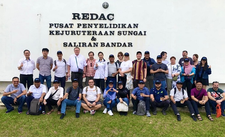
Workshop participants at the River Engineering and Urban Drainage Research Centre (REDAC)
Other than the meetings, outdoor activities were also conducted. The first outdoor activity was spearheaded by the Water Watch Penang (WWP) group involving river education. A demonstration of the conduct of physical, chemical, and biological assessments of a river in Taman Jajar, along with the "catch and release" method of macroinvertebrates, ensued. The participants took part in the activity, further calculating the number of present species and determining the water quality according to the Biological Water Quality Index. Moreover, the participants had a tour of the River Engineering and Urban Drainage Center (REDAC), located within the engineering campus of USM, where they listened to lectures on flood mitigation measures, the use of bio-ecological drainage systems (BIOECODS), and a primer of their programs in Water Resources Management.
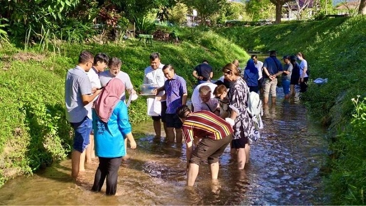
Workshop participants doing physical, chemical, and biological assessments at the Taman Jajar, Sungai Ara.
Now in its third year of implementation, the geoDRR project continues with capacity-building among the project’s participating HEIs in pursuit of their goal of developing a two-year degree master's program in geoDRR and the establishment of research facilities in the six (6) Asian-partner universities.