WebInfo
Kristohanong Katilingban sa Pagpakabana – Social Involvement Office (KKP-SIO) is the social formation arm of the University. It engages students and faculty to social outreach initiatives anchored on the University’s thematic agenda for research and social outreach by partnering with various stakeholders.
KKP-SIO envisions a sustainable and climate resilient Mindanao where XU graduates take active role in the fulfillment of this vision. The office is focused on institutionalizing the social dimension of Xavier Education and Formation; heightening social awareness and engagements among the members of the XU community, partner communities and the city; and engaging in the integral formation of children and youth through participation and collaboration.
The following services are offered within and outside the university premises:
- Copy editing
- Copyright registration
- The National Library of the Philippines Registration
- ISSN
- ISBN
- ISMN
- Printing
- Peer-review
- Graphic Design and Lay outing
- Managing
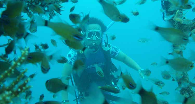
In 2008, the Xavier University - McKeough Marine Center spearheaded the establishment of the Macajalar Bay Development Alliance (MBDA) to implement Integrated Coastal Management (ICM) in one of the most important bays in the Philippines, the Macajalar Bay. The Bay is a major fishing ground in Misamis Oriental of Region 10, Northern Mindanao. It is 50-km wide at the mouth and 30-km long, with an area approximately 1000 km2. Further, it is the gateway to Northern Mindanao, with heavy, medium, to light industries, with rapid development and strong coastal migration, threatening the condition of the bay.
MBDA is composed of the provincial government of Misamis Oriental and 14 coastal local government units (LGUs), namely: Cagayan de Oro City (Chartered), El Salvador City (Component), Alubijid, Balingasag, Binuangan, Jasaan, Kinoguitan, Lagonglong, Laguindingan, Opol, Salay, Sugbongcogon, Tagoloan and Villanueva.
The local chief executives of the member-LGUs sit in the Council, which serves as the highest policy and decision-making body of the alliance. Concurrent to the national elections, the Council elects its Chairperson, Vice-Chairperson, Secretary and the Treasurer which constitute the Executive Committee. The Council also appoints at least its agriculturist, planning and development officers as members to the technical working group (TWG) who closely coordinate with various sectors in the implementation of ICM plan in the Bay. Currently, the MBDA has five TWG components namely: Coastal Law Enforcement, IEC, Habitat and Resource Management, Policies and Good Governance, and Monitoring and Evaluation. The 14 coastal municipalities and cities are further divided into four clusters to identify key issues that need to be addressed and implemented jointly as an alliance. The Program Management Office (PMO) of the MBDA is the main project and program development body, represented by a PMO Manager and 8 officers who also sit as the TWG and Cluster coordinators of the alliance.
The MBDA has been doing its programs and projects in close collaboration with various stakeholders such as the Department of Environment and Natural Resources, Bureau of Fisheries and Aquatic Resources, Philippine National Police - Maritime Group, Philippine Coast Guard, Maritime Industry Authority, Department of Interior and Local Government, Mindanao Development Authority, Gesellschaft für Internationale Zusammenarbeit GiZ, RARE, Partnerships in Environmental Management for the Seas of East Asia, STEAG Power Inc, Mindanao State University - Naawan, and Xavier University - Ateneo de Cagayan.
Vision
A strong, viable and well-managed alliance implementing genuine, responsive and relevant ecological, social and economic programs, through knowledge building, strengthening empowerment and enhancing good governance with committed officers and staff, ably supported by responsible stakeholders in the conservation, rehabilitation and sustainable development of coastal resources in Macajalar Bay.
Mission
To adopt environmental conservation and management for sustainable development, thus, improving the quality of life of the people in Misamis Oriental, Northern Mindanao.
Goals
- Capacitate and strengthen its stakeholders to conserve and restore coastal ecosystems as key assets which support human well-being and security in Misamis Oriental;
- Formulate and implement policies and guidelines on Bay-wide Integrated Coastal Resources Management Plan for the Macajalar Bay with its stakeholders;
- Install and enhance effective and sustainable mechanisms for coordination between and among member-cities and municipalities; and
- Ensure an integrated and sustainable management of the upland, lowland, river system and coastal resources of the bay including solid waste management (ridge to river approach).
Objectives
- Strengthen the environmental sustainability of coastal development in Macajalar Bay;
- Promote the investment of funds and effort in coastal ecosystem management and ridge to reef approach; and
- Empower the stakeholders in the conservation and rehabilitation of each coastal resources.
Main tasks of the MBDA are:
- Implement integrated coastal management in Macajalar Bay;
- Implement comprehensive law enforcement with key agencies;
- Harmonize fishery ordinances;
- Capacity enhancement of LGUs and partners in ICM;
- Monitor and evaluate coastal resources and other ICM-related aspects in the bay;
- Establish Marine Protected Areas (MPAs) Network;
- Resource Mobilization; and
- Advocate ICM and MPAs
Description
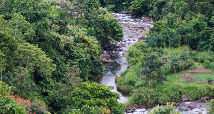
The project aims to provide economic incentives to local initiatives sustaining the flow of ecosystem services in the integrated but vulnerable landscape of the Cagayan de Oro (CDO) river basin (137,000 ha) in Mindanao, Philippines. The whole landscape had become undervalued and no longer has the potential value to provide ecosystem services (ES) due to the unsustainable land use, watershed degradation and climate change. The outcome of these factors had caused the area to become vulnerable and prone to more serious casualties caused by natural catastrophes like Typhoon Sendong (Washi) in 2011 and other supertyphoons, unable to fully rehabilitate, sustain and protect itself from such tragedies.
Environmental degradation being a major factor in disasters propelled the creation of sustainable and long term-solutions, which include forest management and a behavioral shift to the “new normal.” With this idea in mind, adoption of a river basin-wide Payment for Ecosystem Services (PES) is one of the strategic ways to restore, enhance and safeguard the continuing flow of ecosystem services, amongst which is flood control and adequate water supply. This will showcase an Ecosystem-based Adaptation (EbA) to vulnerability to disasters and a changing climate. PES program was born together with Valuing Ecosystem Services Together (VEST), an offshoot campaign aimed at engaging different sectors in the region to take part in this venture.
Goal
To reduce risks brought about by natural disasters in Northern Mindanao through the strengthening and rehabilitation of the whole landscape integrity ensuring continuous provision of ecological services. At the same time, it will provide due recognition and commensurate rewards of the indigenous communities intergenerational efforts on environmental and biodiversity conservation.
The project specifically aims to
- Implement PES agreements based on the modalities created by Resources, Environment and Economics Center for Studies Inc (REECS) in Mt Kalatungan and expand the monitoring and evaluation (M&E) in the entire river basin;
- Establish mechanisms for PES in the adjacent Mt Kitanglad with local communities as guardians and stewards of critical natural resources;
- Facilitate policy lobbying of PES/EbA-related laws in the local government units; and
- Provide assistance in the development and integration of PES in the Cagayan de Oro River Basin Master Plan.
Significance to community
- Strengthens the DRRM in the local level, ensures ridge-to-reef rehabilitation;
- Rewards economic incentives to our partner tribe and promotes cultural solidarity (“tulugan” as tribal hall and just compensation for forest guards);
- Promotes sustainable development for the future of the tribe and people from the downstream; and
- Underscores people’s participation to systematically avail ecosystem services (flooding control and adequate water supply).
Beneficiaries
In this project, a social mechanism for rewards will be developed to benefit local custodians and guardians of natural habitats and continuous provision of environmental services in Northern Mindanao. By scaling up the PES, we are clustering the target groups into the following:
Sellers > Fund Manger > Buyer
Ecosystem services: Flood control and Adequate water supply
The upstream indigenous peoples associations will be the "main sellers" of the ecological services:
- For Mt Kalatungan, the members of MILALITTRA (Miarayon-Lapok-Lirongan-Tinaytayan Tribal Association) serve as the resource managers working in the sub-watershed in Batang; while
- For Mt Kitanglad, the Kitanglad-wide Council of Elders with the Tribal Guards (Kitanglad Guard Volunteers) serves as the sellers.
Xavier Science Foundation (XSF), a third-party fund manager, serves as an intermediary between the IP sellers and buyers of the ecosystem services. The funds will be centralized to the fund manager and the sellers will still provide a community development plan.
The role of the Cagayan de Oro River Basin Management Council (CDORBMC) is to oversee the overall impact of the PES implementation in the entire river basin. This will be composed of Dr Hilly Ann Roa-Quiaoit as the CDORMBC head secretariat, technical officer Analyn B Mejares, administrative officer Sue Andrey Ong from the PES team and selected experts of related disciplines (eg economist, agriculturist etc).
There are five target sectors that benefit from these ecosystem services had been identified, namely, the corporations, cooperatives, schools, church and households. The conscious recognition on supporting the PES project would ensure the continuous flow of ecological services for their operation to succeed and sustain and introduce the PES method to the household level.
Project Management Team
Dr Hilly Ann Roa-Quiaoit
Project Team Leader|XU Vice President for Research and Social Outreach
Analyn B Mejares
Technical Officer/Environmental Scientist/PES Expert
Sue Andrey C Ong
Project Assistant/Biologist
PES Social Marketing
Evans Rosauro I Yonson
Social Marketing Supervisor/Development Communication Expert
Anthony Jacob C Karagdag
Social Marketing Associate/Graphic Designer
Stephen J Pedroza
Content Writer/Editor/Social Marketing Officer
IP Social Marketing
Ma Easterluna Canoy
Project Coordinator on IP Social Marketing
Executive Director of Kitanglad Integrated NGOs (KIN)
PES Team
Dominador D Decano
Team Leader/Speaker
Roland V Rivera
Marketing Officer/Speaker
Josephine Tulang- Decano
Finance, Admin and Marketing Officer/Speaker
Horacio Marcos Mordeno
Writer/Media Relations and Promotions Officer
Team of IP Speakers and Council of Elders
- Datu Adolino L. Makapukaw – Lantapan
- Bae Adelina D. Tarino - Malaybalay City
- Datu Elito Guinoay - Talakaag
- Datu Primo Toto - Talakag
- Datu Romeo Tagnoay - Talakag
- Datu Leodie Caare - Manolo Fortich
- Datu Alfredo Lake - Baungon
- Datu Juvidy Deconlay - Impasugong
- Bae Erlinda Bonye - Malaybalay City
- Bae Edelita Sayongan - Libona
Copper and Arsenic Recovery as a Post-Mining Activity using Indigenous Plant Hyperaccumulators under the program: “Program for Rehabilitation and Restoration of Mining Areas Through Phytotechnologies” is a three-year research.
This project tries to understand the potential of hyperaccumulators in the remediation or rehabilitation of areas affected by mining and also their capability of absorbing metals in anomalous amounts. The physiology of hyperaccumulation should also be well understood.
There is a need to strike a balance between elements to enhance the phytoextraction of 1 metal over the other. There is also a need to identify more hyperaccumulators as 1 plant may not confer hyperaccumulation for all other metals. Improved understanding of this process would be very useful in phytoextraction and phytomining technologies. The initial phase of the proposed project is aimed towards the identification and propagation of plant hyperaccumulators for copper and arsenic recovery. The subsequent phases will be the development of a technology that can recover the copper and arsenic from the plant.
XU engages in this research project in collaboration with Ateneo de Manila University, University of the Philippines-Los Baños, Caraga State University and University of Melbourne, Australia through Dr. Augustine Doronila as part of the ridge to reef initiatives of the Research and Social Outreach cluster.
General Objective
Identification and propagation of Copper (Cu) and Arsenic (As) hyperaccumulators in large mines and in small scale mining areas for potential Cu and As metal recoveries.
Specific Objectives
- Assess the potential of different plant species for hyperaccumulation of copper and arsenic.
- Determine the biology of 3 to 4 plant hyperaccumulators in mined areas to understand fully their potential for hyperaccumulation. Physiological and cytological characterization will provide a better understanding of the hyperaccumulators.
- Facilitate the propagation of these plants: set up nurseries, transfer the propagated plant materials to experimental plots.
- Evaluate the feasibility of Cu and As and other associated metals) extraction / recovery from the plants.
- Facilitate phytoremediation studies: land stability and minimizing soil erosion, enhance succession and biodiversity in the area.
Significance of the Project
Owing to the mineral wealth of the Philippines, mining has been one of the main sources of livelihood in different areas across the country dating back to pre-Hispanic occupation. At present, the country is one of the major exporters of copper, gold and nickel.
Similar to any other industry, a set of governing rules and regulations are being implemented to ensure that proper operations are being done. In some cases, problems regarding compliance arise, causing undesirable impacts to different sectors, such as the environment. As a result, efforts to provide solutions to such dilemmas are being worked on by concerned institutions.
Phytoremediation has been identified as a feasible environmental approach to restore or improve ecologically degraded land forms which resulted from poor mining practices.
The presence of high amounts of metals in the soil is generally detrimental to most plants. The Mineral Recovery Research team is in search of plants that can survive in these areas and take up high amounts of Cu and As from metal-rich soils to their biomass. These plants will be used in the rehabilitation of mined-out areas, followed by the recovery of Cu and As.
The team has identified a total of 7 potential hyperaccumulators of Cu and As (3 flowering plants, 4 ferns) which are currently being mass-propagated in the nursery in Cagayan de Oro for further experimental studies.


 in Response to the Ongoing Tensions in the Middle East")

 on the Drafting of Implementing Guidelines for the Random Drug Testing Policy")


 for AY 2026-2027 | CTTL")
")


