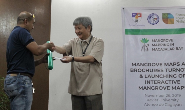
TURNOVER. Xavier Ateneo president Fr Roberto C Yap SJ (right) leads the turnover of the GIS-based mangrove maps. Supplied photo.
Report by Fae Ucat (McKeough Marine Center)
XU McKeough Marine Center (MMC) recently held the turnover of mangrove maps and brochures to the local government units, peoples’ organizations, and some private companies, held at the AVR1 of Xavier University - Ateneo de Cagayan.
The turnover ceremony was attended by the representatives from the LGUs in Macajalar Bay, City Local Environment and Natural Resources Office (CLENRO), City Planning and Development Office (CPDO), City Agriculture Office, FDC Misamis Power Corp, Macajalar Bay Development Alliance, Pilipinas Shell Foundation Inc, Philippine Ports Authority, Steag State Power Corporation, and Xavier Ateneo administrators, faculty, and researchers.
MMC’s Fr Mars Tan SJ, project leader, in his welcome remarks, emphasized that the research study was conducted to produce the latest GIS-based mangrove maps to serve as guides and references for the LGUs, POs, and other stakeholders in their management and rehabilitation of their mangroves.
Tan also shared five major reasons why we need to protect and manage well our mangroves, namely: 1) increase fish and marine resource production; 2) coastal stability and protection; 3) enhancement of biodiversity; 4) positive interconnectivity with corals and seagrasses; and 5) carbon sequestration to mitigate climate change.
The Mangrove Mapping Team led by Chev Duay and Rad Edulan presented photos and a video that narrated their long and challenging journey from social preparations, to actual fieldwork, then to processing of data, until the presentation of results to local communities and the final validation of maps.
Engr Augustini Paduganan of the XU Engineering Resource Center explained to the participants how to access the maps on from the XU website, understand the maps’ features, and make use of the various information contained in each map. Questions regarding the maps were also raised and addressed during the short discussion.
Xavier Ateneo presented Fr Roberto Yap SJ in his inspirational message, highlighted three major things about the project: First, the maps are knowledge products of the collaborative work of Xavier Ateneo faculty, researchers, and its own Biology and Marine Biology graduates. Second, the research is made useful for the social development of local communities. Lastly, the research study is in line with the main theme of Pope Francis’ encyclical Laudato Si, care for our common home.
Yap also encouraged and challenged the recipients of the maps to make use of the information in the maps in their rehabilitation and management of their mangroves.
MMC expressed its gratitude to the Forest Foundation Philippines for their support as the project’s funding partner.∎
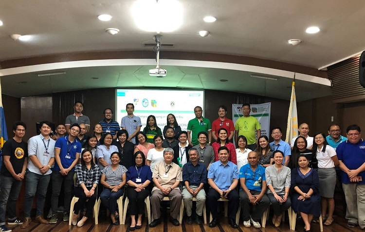
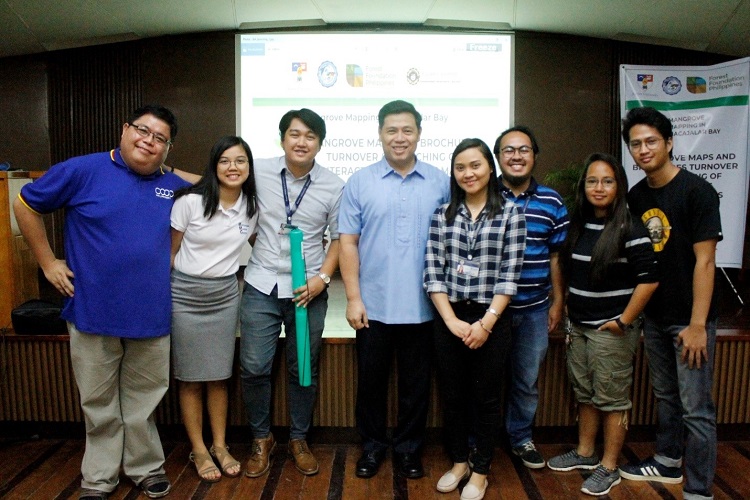
LEADERS. Participants of the “Mangrove Maps Turnover and Launching of the Interactive Maps” pose for a group photo after the program. Supplied photo.
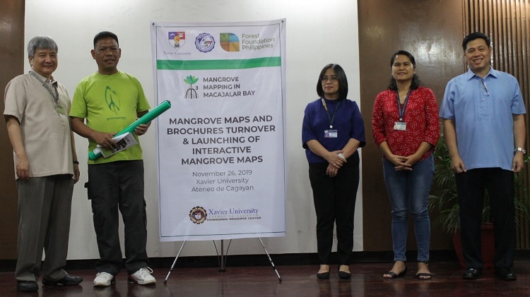
CEREMONY. Fr Roberto Yap SJ distributes the maps and the brochures (mangrove policies) to LGU representatives (LGU of Salay rep Greg D Zulite) assisted by Dr Judy Sendaydiego, dean of the College of Arts and Sciences; Engr Gail de Rita, director of Social Development Office, and Fr Mars P Tan SJ, director of McKeough Marine Center. Supplied photo.
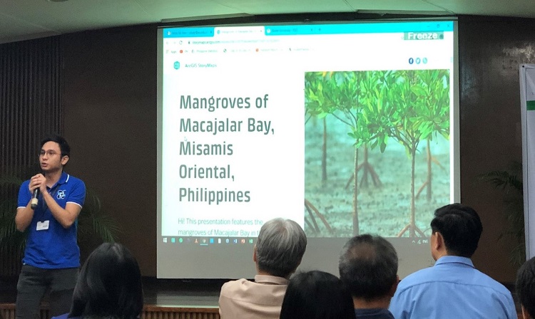
PRESENTATION OF MAPS. Engr Augustini Ave Paduganan of XU-ERC presents the interactive maps to the participants. Supplied photo.
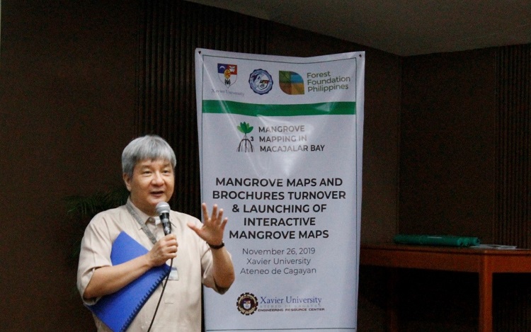
LAUDATO SI. Xavier Ateneo president Fr Roberto C Yap SJ delivers an inspirational message in line with Pope Francis' Laudato Si. Supplied photo.
XU MMC. Xavier Ateneo's McKeough Marine Center officer, the implementing unit of the project and organizers of the event take a group photo after the turnover ceremony. Supplied photo.