A team of faculty, students, and formators from Xavier University - Ateneo de Cagayan has gained international recognition for their innovative approach to engineering education and community engagement through Service- Learning.
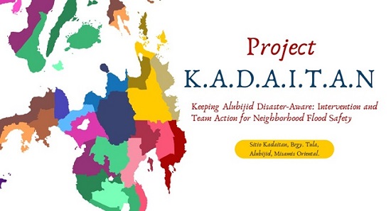
Their study, titled "Bridging Theory and Community: Enhancing Geomatics Education for Civil Engineers Through a Service Learning Pedagogy," was recently published in the Journal of Asian Geography (Volume 16, Issue 1, 2024). The research highlights the success of the K.A.D.A.I.T.A.N. Project, an initiative that integrated academic instruction with real-world disaster risk reduction.
The research was led by Engr Jefferson R Vallente Jr, Assistant Dean of the College of Engineering, alongside Service-Learning (SL) formators Ms Paulyn Erica M Porras and Ms Victoria Melissa C Pulido from the Social Development – Service Learning Program (SD-SLP).
The collaboration emphasizes combining technical excellence with social conscience. By moving beyond the traditional classroom instruction, the team utilized Service- Learning, a pedagogy that blends problem-based learning with structured reflection, ensuring that students do not just learn to be engineers, but "engineers for others."
Central to the study’s success was the active participation of Civil Engineering students who applied their technical skills to address the recurring flood risk of Sitio Kadaitan in Alubijid, Misamis Oriental. Among the student researchers and co-authors identified in the study are: Jungie J Caja (Specializing in Geotechnical Engineering), Maeray Franzie R Roa (Specializing in Water Resources Engineering), and Gem Kevin S Estimos (Specializing in Structural Engineering).
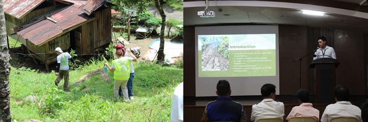
In Photo: Engineering students conduct field visits and output presentations to stakeholders and Municipal Officials during their Service- Learning engagement.
Under the guidance of their mentors, these students produced geomatics outputs, including topographic maps and river easement delineations. These tools are critical for the local government and community leaders in making science-based decisions to mitigate flood risks in an area historically plagued by heavy siltation and overflow from the Alubijid River.
Beyond its technical contributions, the publication marks a significant milestone in the institutionalization of Service-Learning (SL) at Xavier Ateneo. It serves as a definitive case study on how SL functions as both a social formation tool and a social development engine.
The study provides empirical evidence that engaging with Sitio Kadaitan transformed the students' perspectives. By reflecting on the human impact of engineering, the program molds students' empathy and social justice values, aligning with the university's Jesuit mission of cura personalis (care for the whole person).
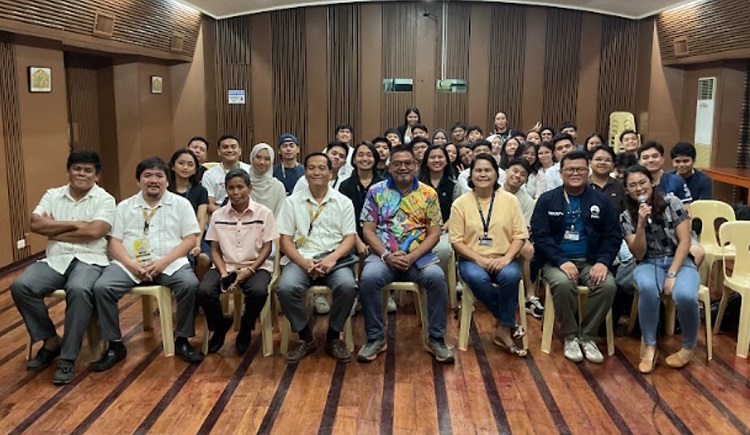
In Photo: CE 23: Geomatics students pose for a photo with local officials of the Municipality of Alubijid, led by EnP Tristan Lindsey Ares,
Municipal Planning and Development Officer. Present in the Output Presentation are Ms Gail dela Rita, SLP Director, Ms Paulyn Erica Porras,
SLP Formator, and Engr Jefferson Vallente, Jr, SL Faculty
Unlike traditional outreach, this Service- Learning model ensures sustainable development. By providing the community with high-quality geomatics data, the university empowers local leaders with the technical capacity to implement long-term disaster mitigation strategies and advocate for infrastructure support.
The inclusion of both Engineering faculty and SL formators as authors signals a shift toward transdisciplinary research and collaboration. This study sets a precedent for other departments to elevate Service-Learning from a curriculum-based activity to a recognized field of scholarly research, proving that academic excellence and community service are inextricably linked.
The study utilized a mixed-methods approach to evaluate the impact of the K.A.D.A.I.T.A.N. Project. Key findings revealed:
- Students demonstrated a significant increase in higher-order thinking, moving from basic comprehension of geomatics to the complex application of GIS (Geographic Information Systems) in flood hazard mapping.
- Participation in the project directly addressed ABET (Accreditation Board for Engineering and Technology) outcomes, particularly in ethics, teamwork, and the ability to understand the impact of engineering solutions in a global and societal context.
- The project transitioned the community from "passive recipients" to "active partners," as the technical maps provided by the students became a basis for local Disaster Risk Reduction and Management (DRRM) planning.
By bridging the learning gaps within the classroom, laboratory, and the field, Xavier Ateneo continues to lead the way in showing how higher education can be a powerful instrument for both individual growth and nation-building.
"This research highlights a novel approach," the authors noted. "By applying geomatics principles to real-world problems, students deepen their understanding of theory while addressing urgent societal needs."
The full study is available for access through the Journal of Asian Geography.