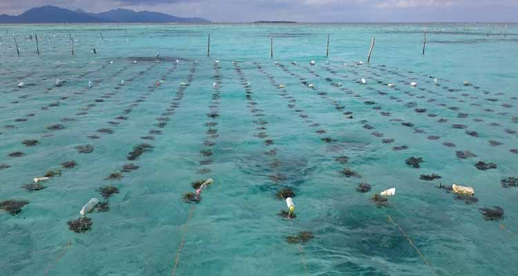
This project attempts to use GIS in developing data and information related to seaweeds in the Philippines, which will be stored in one repository where intended beneficiaries, such as policy makers and seaweed farmers, can access it.
Significance
Seaweed farming is now becoming popular in the Philippines with an estimated area of over 2300 ha (BAS 2004) and latest production of 1,558,378 MT (BAS, 2013). However, very limited information of the culture practices, varieties of the farmed seaweeds and actual farmed areas are available. Thus a massive mapping of farmed areas in the Philippines is necessary with the use of Geographical Information System (GIS), a popular tool for mapping and resource management. GIS is a vital tool in this project for data gathering, benchmarking and data banking. This is to determine the extent of seaweed production in the Philippines and map out culture techniques and other relevant information in each seaweed farm (water quality, seaweed strain, practices, etc.), which can then be accessed by the farmers, partners and LGUs.
There are three GIS-mapping nodes established to cover large area of the Philippines in partnership with selected institutions in strategic locations, as follows:
Node 1: Xavier University-Ateneo de Cagayan
Areas
Central-Northeastern Mindanao to Eastern Mindanao: Misamis Oriental, Agusan del Norte, Surigao del Sur, Surigao del Norte, Dinagat Islands
Visayas: Bohol, Cebu, Negros, Antique, Siquijor, Samar, Leyte
Luzon: Bicol, Palawan, Camarines Norte, Camarines Sur, Ilocos Norte, Batangas, Masbate, Albay, Catanduanes
Node 2: Mindanao State University (MSU)-Naawan
Areas
Central- Northwestern Mindanao to Western Mindanao: Misamis Occidental, Lanao Norte, Lanao Sur, part of Zamboanga del Sur & Norte
Node 3: Southern Philippines Agri-Business and Marine and Aquatic School of Technology (SPAMAST)
Areas
Southern Mindanao to Southwestern Mindanao: Davao del Sur/Norte, Davao Oriental, Sarangani province, Tawi-tawi, Sulu
Xavier University is the central hub and provides expertise in GIS while member institutions participate by providing information using uniform datasheets which includes the various different parameters. The project starts with a training workshop on GIS familiarization, and recommended protocols and formats for data gathering.
After the training, data collections are performed by participating agencies/Universities in their assigned area of responsibility. Data is submitted, using standard format, to Xavier University for processing. The three nodes supervise and provide travel funds to participating institutions within their area of responsibility for the ground-truthing and mapping of seaweed farms. These are being analyzed and integrated by the nodal centers before submission to the central hub at Xavier University.
DOST-funded projects on seaweeds are being collected, also literature and other information for review and integration. The Marine Science Institute of the University of the Philippines (UPMSI) collaborates to provide information on seed banking and the areas of propagations of their seed propagules/ varieties. Further, the Seaweed Industry Association of the Philippines (SIAP) and Bureau of Fisheries and Aquatic Resources (BFAR) also as collaborators provide information regarding existing data production areas and their respective contact details, information on processing and list of partners/members that they would like to be included in the mapping.
